Racquel Moses, CEO of the Caribbean Climate-Smart Accelerator discusses the Climate Smart Map, a platform designed to track impacts, surface solutions, and connect projects to capital.
>>Watch the video below. View Part 2 here.
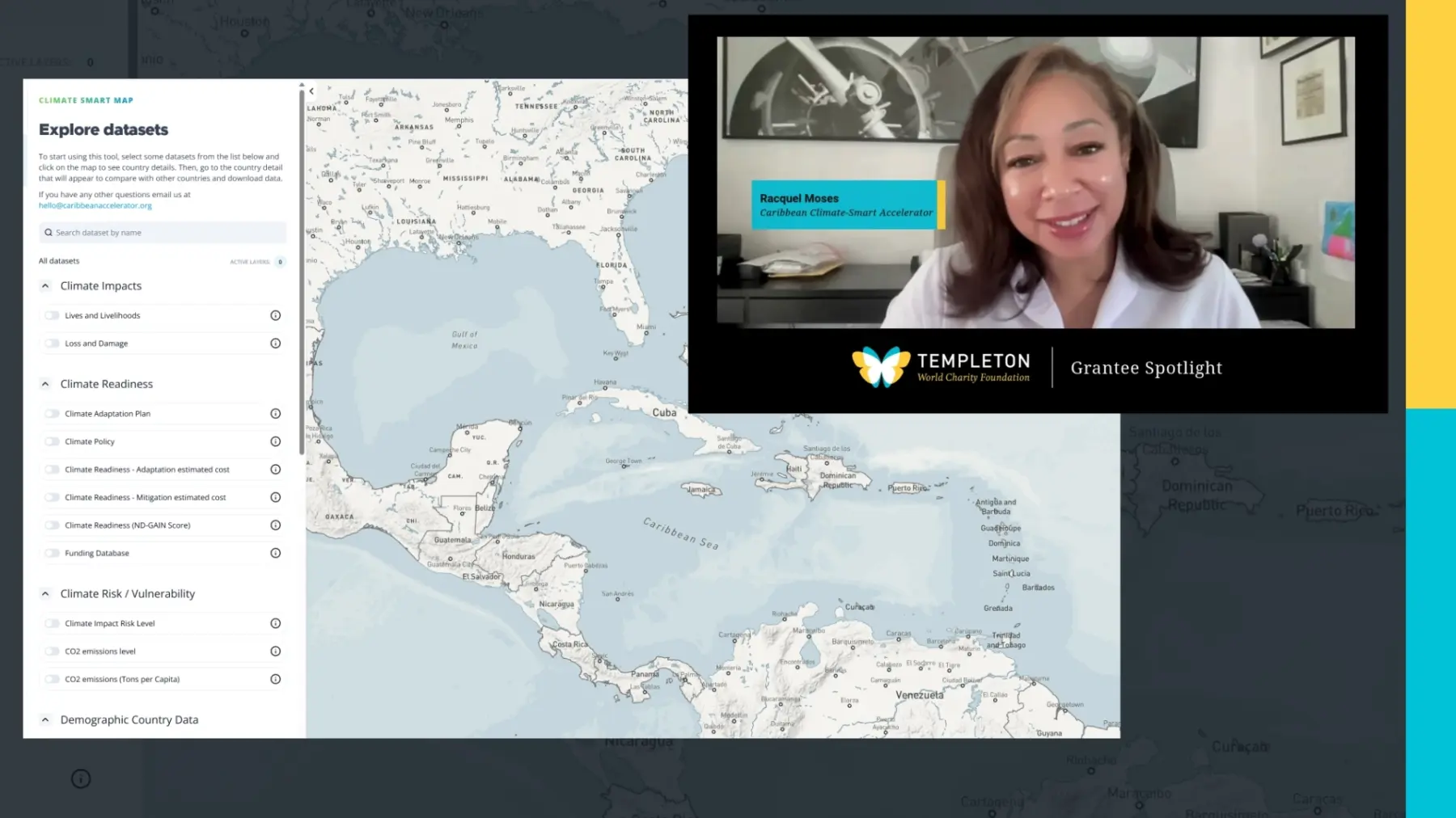
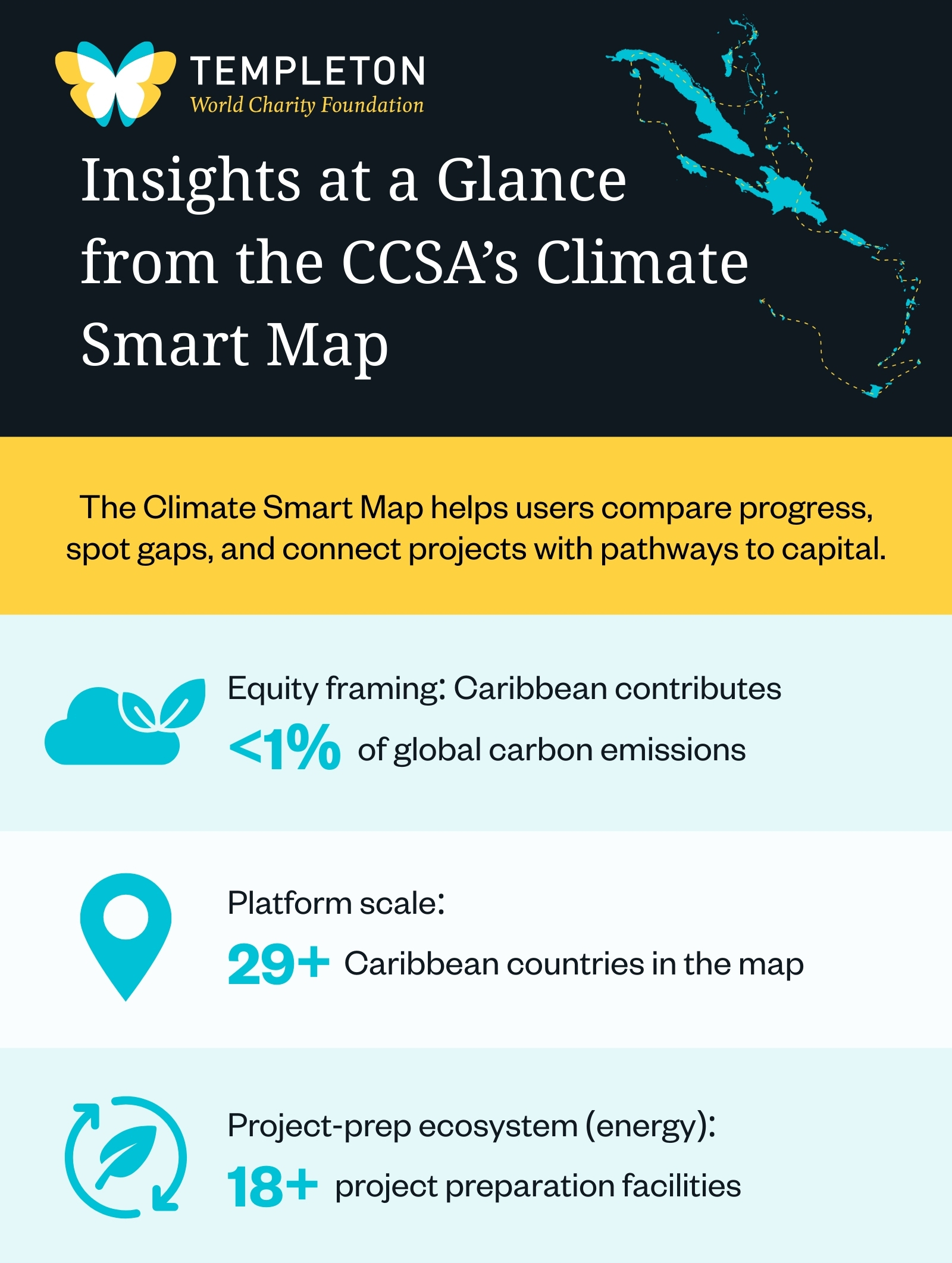
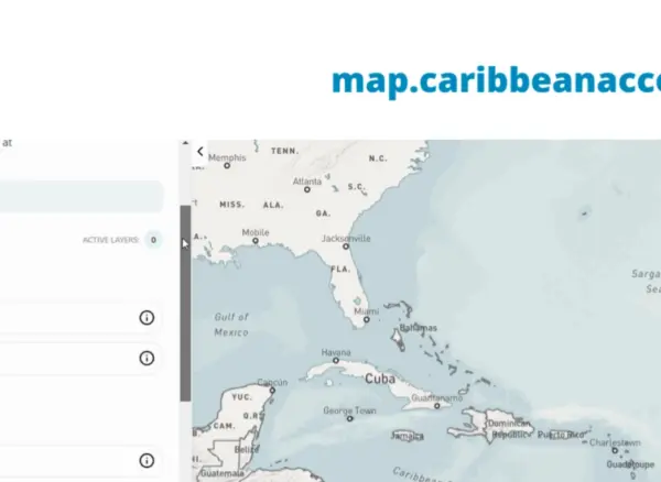
Launched in December 2023 at the Conference of the Parties (COP28) in Dubai, The Climate Smart Map is the first tool of its kind — an interactive platform consolidating climate data from more than 29 Caribbean countries, including information that was previously scattered across agencies or simply unavailable.
"We're really proud of this Climate Smart Map," Moses shares. "The first thing we want it to do is provide economies of scale across the region. When investors or philanthropists look at us, they typically don't focus on us because they think we're too small. But when you start looking at us on a regional basis, batching countries together, you will find that we have the ability not only to deliver impact, but to be transformational."
To date, innovation in climate adaptation across the region has rarely made international headlines – something Moses hopes will change with the launch of the Climate Smart Map. "We are typically characterized as the victims of climate change," she said. "And we are, our vulnerability is unparalleled. But we are also quite victorious when it comes to creating new solutions."
The platform is one such solution — and is the first of its kind to cater to such a wide variety of users.
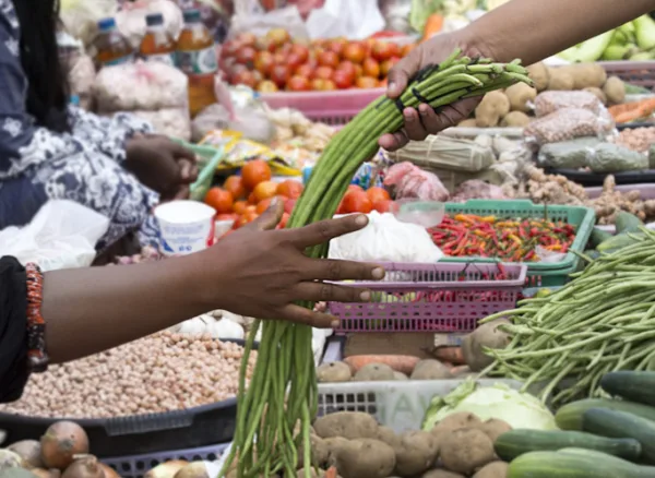
From policymakers keen to share best practices and compare their country's progress against regional peers to journalists eager to ensure they gather reliable information about whether governments are meeting their stated commitments to students and climate activists who want to access data that will help them to hold countries accountable; funders and investors searching for projects seeking capital; and entrepreneurs looking for gaps in the market as well as financial resources like stock exchanges and project preparation facilities.
This regional perspective is central to how the platform works. Users can overlay datasets on climate vulnerability, explore demographic and economic information, including GDP, utility capacity and governance affiliations like CARICOM membership, and compare national climate commitments against actual progress. External resources on coral reefs, mangroves, sargassum and hydrogen development help integrate high-level country data with more granular environmental indicators.
Equally critically, the platform functions as a matchmaking tool. By listing climate adaptation and mitigation projects across member countries alongside information about project preparation facilities, developers are able to access information that can help them get their initiatives to "bankability." For funders looking to deploy capital, as well as entrepreneurs seeking support, the directory fills a vital gap previously not addressed.
"People weren't aware of how many project preparation facilities we have across our region," said Moses. "For energy alone, there are 18." One facility told CCSA the platform helps them identify coverage gaps and better allocate incoming resources — exactly the kind of coordination the region has long needed.
Before the platform existed, regional climate data was scattered among national agencies, international bodies and research institutions, if it existed at all. "Even Google sometimes does not know what is happening in the Caribbean," noted Kiesha Farnum, head of partnerships at the the Caribbean Centre for Renewable Energy and Energy Efficiency (CCREEE).
In addition to aggregating data sets, the platform is also helping to measure progress. Under the Paris Agreement, signatory countries submit Nationally Determined Contributions (NDCs) outlining their climate commitments. But tracking how far they've come is difficult. By allowing users to compare stated goals against current realities, the platform serves as a prototype for ongoing monitoring, as well as a potential supplement to the UN’s periodic global stock-take.
For Moses, success will ultimately be measured by the stories the platform helps tell, as well as the impact those stories make. "It is how we use the map to tell our stories," Moses said, "and the results of that storytelling in real impact on the ground."
Her hope is that the international press will use the platform to showcase Caribbean leadership and innovation as opposed to focusing only on vulnerability. And that entrepreneurs will say, "I was able to use the map to determine the needs of the region and developed a new solution based on the data." Similarly, she is optimistic philanthropists will come to understand how a grant that might seem modest in other contexts could catalyze significant energy independence across multiple Eastern Caribbean countries.
In Part 2, Moses reflects on what the Climate Smart Map revealed after Hurricane Melissa — and why the region’s losses still vastly outpace available loss-and-damage funding.